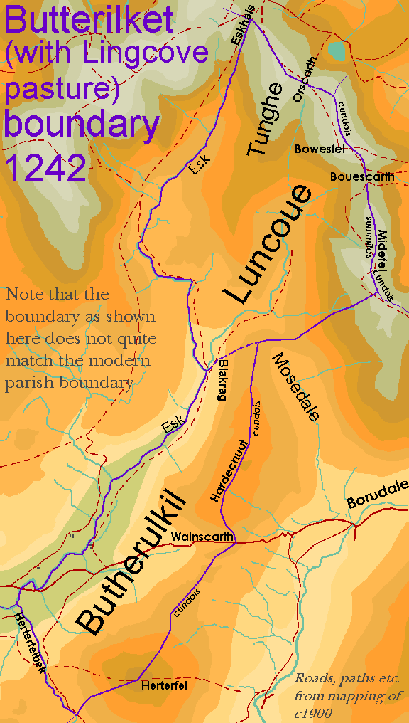
I have also made assumptions about the locations of various named features, notably Harterfell Beck (which I have based largely on a slight kink in the modern parish boundary).
Furthermore, this map does not take account of changes in the course of the Esk, which will be explored in detail on other pages of this website.